OpenWetlandsMap: an openly accessible and community-maintained dataset of wetlands observations
The bottom line: we’re building the first community-maintained dataset of wetland observations to fill a critical data gap, and we need your help.
What is the problem?
Growing up, we would often go visit my grandparents in the mountains of North Carolina. When we went out to dinner on Sundays, my grandfather insisted on giving directions like this: “go down the road by where the old burger place used to be, turn right by my elementary school, keep going until you see that big rock and then make a U-turn. When you see the old tree that burned down three times, turn right into the parking lot.” Of course, the old burger place is now a Walmart shopping center, his elementary school is now a museum, and the big rock has mysteriously disappeared. If I followed his directions, which are based on his outdated mental map, I would get lost all the time! However, since we have great maps of our roads and buildings, I can easily get directions to our favorite pizza place using an app on my phone.
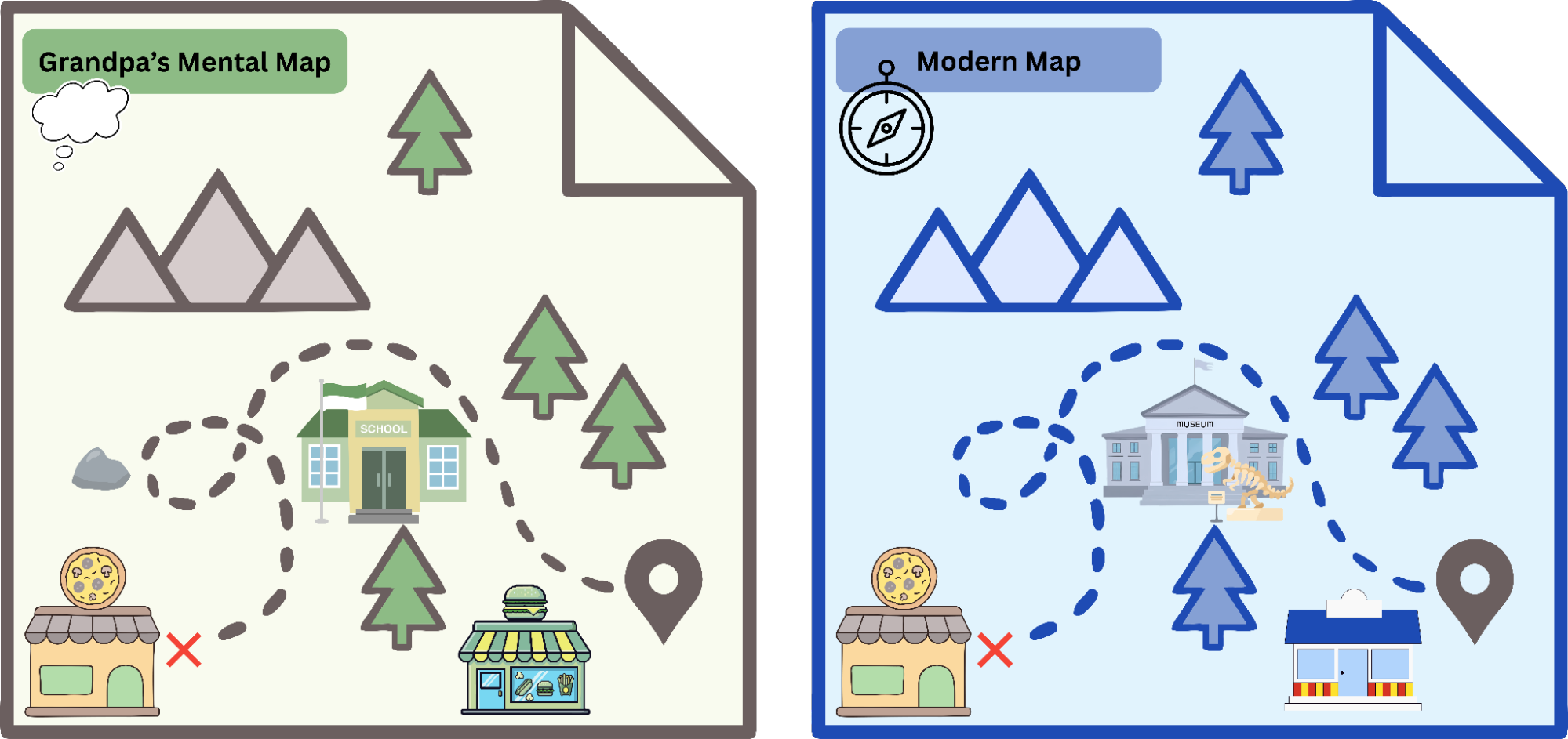
When it comes to finding wetlands, we often only have the directions from my grandfather. The data are old, and in some cases, also hasn’t been updated since the 1970s or 80s. But wetlands are the most productive ecosystems on Earth — storing more carbon than forests, hosting greater biodiversity than tropical rainforests, and providing over $30 trillion annually in ecosystem services including flood control, water filtration, and storm surge protection for vulnerable communities. As very dynamic landscapes, having out-of-date wetland maps has resulted in an inability to understand the pace and scale of changes in wetlands and decision-making based on incomplete information. In other words, it’s hard to protect, restore, and avoid impacts to wetlands when we don’t know where they currently are.
What are we doing to address this?
To address this problem, EPIC and over 50 partners from over 30 different organizations have been meeting regularly to discuss improvements to the wetland data landscape. From our discussions, we have identified the need for an OpenWetlandsMap. Leveraging the OpenStreetMap framework, this will be an openly accessible and community-maintained dataset of on-the-ground observations of wetlands in the United States. This map will be designed in collaboration with OpenStreetMap US in a pilot location and with input from a diverse community of experts to capture the nuance of wetlands across different landscapes.
Leveraging the collaborative power of a community-maintained dataset can allow us to:
Engage local communities and citizen scientists in wetland mapping.
Identify and highlight gaps in wetland mapping.
Increasing the accessibility of field data to train and validate high quality models of wetland locations.
If successful, this project will have cascading benefits for:
Agencies stewarding wetlands through better quality conservation and restoration plans.
Advocates and restoration practitioners seeking to protect and restore wetlands.
Project developers seeking to avoid impacts to wetlands and associated costs.
Communities’ ability to have and build resilience to climate change and destructive events.
What can I do?
In order to build the OpenWetlandsMap, we need your help! Whether you are taking pictures of a wetland on your daily walk or taking detailed measurements of wetlands for a citizen science project, we want to ensure this map is built and designed with you in mind. Please take a moment to provide your thoughts using this form.
With your help, just like the maps to get me to our favorite pizza restaurant near my grandfather's place in the mountains, the OpenWetlandsMap will help us find, protect, and restore our nation’s wetlands!
Acknowledgements
This work is guided by the Wetlands Deep Dive community of national wetland and data experts, whose feedback, thoughts, and ideas are continuously shaping the OpenWetlandsMap.